


Several rounds of snow could mean about 15″ in southwest Colorado
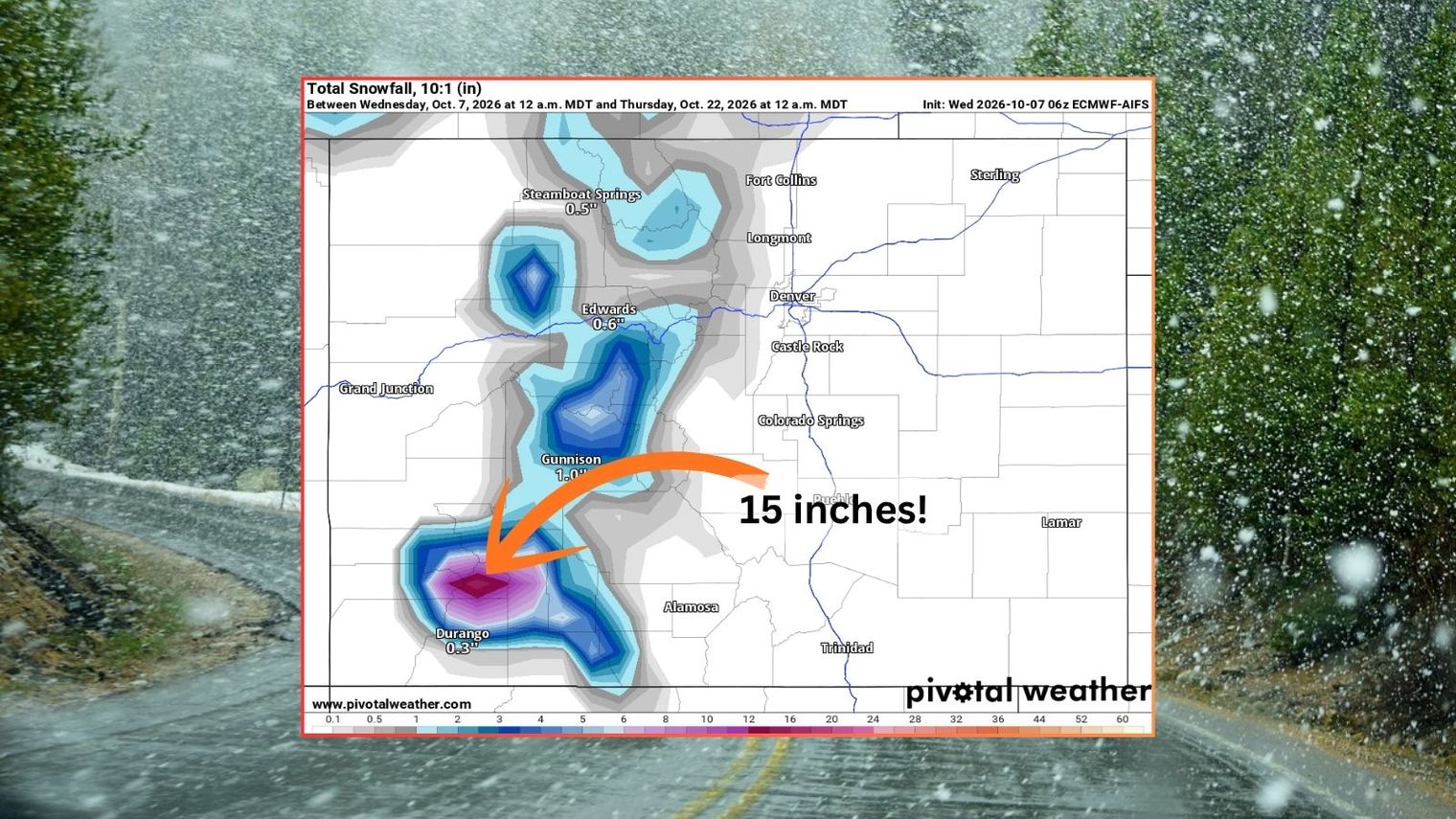
Multiple rounds of snow are forecast to impact southwest Colorado over the next three weeks, with high peaks in the region potentially accumulating around 15 inches by late October. The first system arrives this weekend, followed by additional snow mid-week and again in mid-October. Most major population centers and ski resorts near Denver will see minimal accumulation.
Key points
- Southwest Colorado peaks could receive 15 inches of snow through October 22. The total comes from three separate snow systems occurring this weekend, mid-week, and around October 17-18.
- First snow arrives Saturday night through Monday morning, dropping five inches north of Durango. Peaks between Gunnison and Aspen will receive a couple inches from this initial system.
- Second and third rounds of snow will add significant accumulation by October 22. After two waves, southwest peaks should total about 11 inches, with areas near Aspen reaching five inches.
- The Elks and Flat Tops mountains will see about six inches total, while northern Colorado gets a couple inches. Front Range peaks and mountains near Denver and Colorado Springs will "end up mostly missed if the current Pivotal Weather forecast comes to fruition."
- Summit County resorts including Arapahoe Basin, Keystone, and Loveland should see limited snow. These early-opening ski areas will likely remain closed, as the accumulation will be insufficient to support operations.
- Wolf Creek Ski Area near Pagosa will receive more snow than other resorts but still insufficient for opening. "A late-October opening for at least one of Colorado's ski areas has become the norm," depending on snowmaking conditions and temperature support.
Summarized by MalakyeAI